Between Vancouver Island and the Discovery Islands in British Columbia, lies a narrow body of water called Seymour Narrows, which is part of larger strait called Discovery Passage. The Discovery Passage is frequently used by vessels, including cruise ships and freighters, because it enables them to avoid some of the bad weather in the open ocean. The Seymour Narrows, however, has its own hazards. It is very narrow and is known for strong tidal currents. And right in the middle of the strait, below the waters, lurks an underwater mountain called Ripple Rock.

Before this mountain was blown up, it had two peaks that produced large, dangerous eddies from the strong tidal currents that flowed around them. At low tide, the mountain left only three meters of clearance, and was a serious hazard to shipping. Before 1958, it claimed more than a hundred ships, big and small, and as many lives. George Vancouver, who first noted the rock’s existence in 1791, described it as “one of the vilest stretches of water in the world.”
Suggestions to remove the rock was made as early as 1931, but it was not until 1942 that the government authorized its removal. This decision caused bitter opposition among some, who had envisioned linking Vancouver Island to the mainland at Bute Inlet, using Ripple Rock as a mid-support for the bridge. But the government decided that making the waterway safer was a bigger priority, because it provided a channel linking the northern part of the continent to the rest of Canada and the U.S.
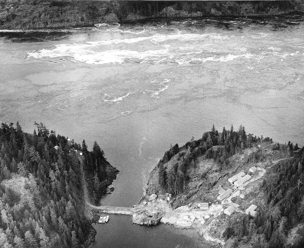
The Seymour Narrows before the Ripple Rock was blasted. Notice the violent turbulent eddies that formed in its wake during low tide. Photo: Wikimedia
The following year, engineers began drilling holes into the top of the rock. For this purpose they floated a drilling barge over the rock, held in place by one and half inch thick steel cables attached to concrete anchors. But the barge quivered and moved so much in the violent waters that anchor lines snapped and the attempt was aborted.
A second attempt was made in 1945. This time in addition to the anchors the barge was attached to two enormous steel overhead lines, each weighing 11 tons. But still the barge tossed in the turbulent waters, and after drilling only 139 holes out of the estimated 1,500 needed, this plan too was abandoned.
Eight years later the National Research Council commissioned a feasibility study to determine whether Ripple Rock could be reached from the nearby Maud Island rather than directly from above. The idea was to sink a shaft from Maud Island, go under Seymour Narrows, and up into the peaks of Ripple Rock. Based on the recommendation, a 570-foot shaft was sunk from Maud Island, and from the shaft, a 2,500-foot tunnel was driven to the base of Ripple Rock, where it divided into branches for the two pinnacles. From the base of the two peaks, vertical tunnels were dug and from there a series of “coyote” shafts were drilled for the explosives. A total of 1,270 metric tons of Nitramex 2H explosive was placed in these shafts, estimated at ten times the amount needed for a similar explosion above water.

Schematic drawing showing the mining of Ripple Rock.
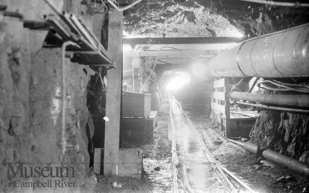
The tunnels underneath Seymour Narrows.
Related: The Blowing Up Of Hell Gate
Expecting a spectacular show of force, the United Kingdom's Atomic Weapons Research Establishment at Aldermaston sent a delegation of nuclear weapons scientists to Canada, and they set up various monitoring instruments to record data from the explosion. The blast also created considerable scientific interest in the field of seismology. The Seismological Service of the Dominion Observatory undertook a project to measure the time of travel of the seismic waves from Ripple Rock to various seismograph stations located in British Columbia. From these experiments they learned that the high mountain along some routes may have roots extending beneath the earth crust into the mantle.
The explosion went off at 9:31:02 AM on 5 April 1958. The timing of the blast was carefully chosen so that there was minimum load of water over the rocks, and at the same time the maximum current to promote rock dispersal. The effect the blast might have on migrating salmon was also considered, and hence the spring season was chosen as at that time migration was close to minimum.
More than six hundred thousand metric tons of rock and water were thrown up into the air that reached heights of 300 meters. The spectacle was watched on live TV across the nation. Before the blast occurred, everyone was very concerned about what damage this blast was going to cause. An area of radius 5 kilometers from the explosion was cleared off people. Some local residents boarded up their windows and headed for higher ground on the morning of the explosion, worried about tidal waves and aftershocks. Fortunately, the water dampened the explosion and the sound. Many people in Campbell River, only a few kilometers away, saw the blast on TV but heard nothing.
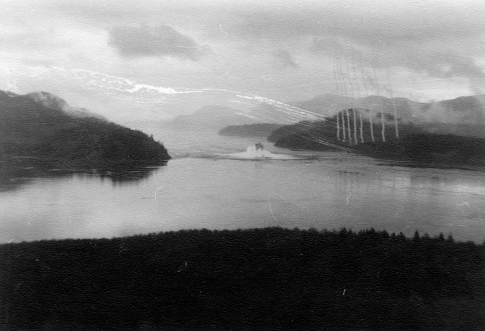
The blast breaches the water's surface immediately following detonation.

Debris are ejected as a cloud of dust expands across Seymour Narrows.
The explosion shaved off the top of the peaks by more than 65 feet, such that at low tide, there is now 75 feet of water instead of 9 feet previously, and over the entire area, there is now a least depth of 70 feet. The Seymour Narrows is no longer as dangerous as it was more than sixty years ago.
References:
# Museum at Campbell River
# 60 years later, a major underwater explosion in B.C. still fascinates, CBC News
# J.l.A. Rutley, The Demolition of Ripple Rock

Comments
Post a Comment