When we talk about "limes", we usually think of the limits of the Roman Empire in northern Europe, in Germania or Britain. But in reality, that word means "border" and therefore applied to the boundaries in all cardinal points. So, if the Rhine River marked the Germanicus Limes and Hadrian's Wall marked the British Limes, there were also Limes Alutanus and LimesTransalutanus (along the Danube), a Limes Moesiae (between present-day Romania and Moldova), a LimesTripolitanus (in northern Africa, extended with the Fossatum Africae), and an Limes Eastern (along the Euphrates). The latter was the Limes Arabicus, a chain of forts that protected the Roman territory from desert tribes.

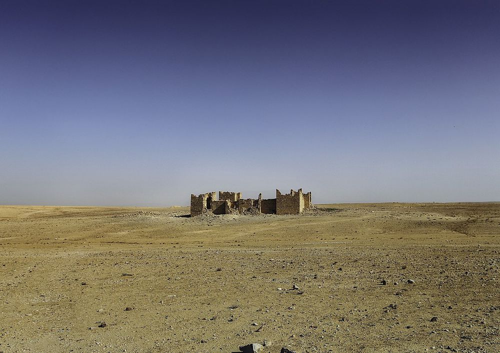
Ruins of the castellum of Qasr Bashir. Photo: Bashar Tabbah/Wikimedia
The Limes Arabicus, or at least a part of it, was also later known as the Limes Palestinae because it ran for a maximum of one and a half thousand kilometers between southern Palestine and northern Syria. Let us consider that this vast region was conquered and turned into a Roman province in 64 BC by Pompey, with the aim of ending the instability of the Seleucid Empire (the last remnants of the states that divided the legacy of Alexander the Great and which were embroiled in a civil war between Antiochus XIII and Philip II), which by then had seen its domains reduced to that area.
The new province was expanded in 106 AD when Trajan annexed Nabatea, a kingdom that had its capital in Petra and was founded five centuries earlier by King Aretas I, uniting the nomadic Bedouin tribes of the Arabian desert. In this way, the Arabicus Limes moved about three hundred and fifty kilometers to the south, reaching the Red Sea. This expansion also increased its usefulness because, while it was originally conceived to defend the fertile lands that Rome had taken from the Parthian Empire, from then on it also protected the rich commercial routes in the area and exercised control over the migrations of nomadic peoples.

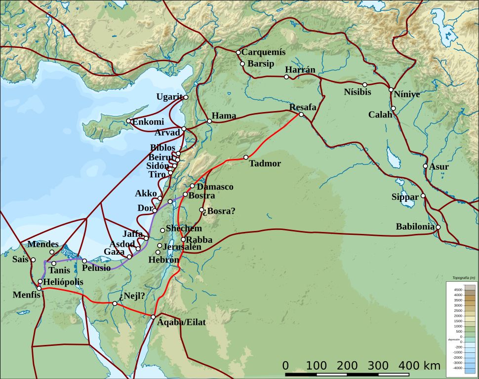
King's Highway (in red), and other ancient Levantine trade routes, c. 1300 BCE. Image credit: Briangotts, rowanwindwhistler/Wikimedia
Arabia Petraea, as that political-administrative division was called, encompassed a stretch of present-day Jordan, southern Syria, the Egyptian Sinai Peninsula, the southern region of Israel, and the northwest of Saudi Arabia. To the east was Arabia Deserta and to the south was Arabia Felix, that is, the regions of the Arabian Peninsula free from Roman rule. To the north was the province of Syria and to the west were Judea and Egypt.
All of this was connected by a road, the Via Traiana Nova, which was built by Trajan between 107 and 114 AD (although the finishing touches were made during the time of his successor, Hadrian). It had a total length of four hundred and thirty kilometers, following an ancient caravan route called the Kings' Road.
That double-lane infrastructure, with a width of six meters, was built by the men of Legio III Cyrenaica under the command of the legate Gaius Claudius Severus, and originally connected Petra with Philadelphia (now Amman). It was then expanded to the port of Aila (now Aqaba) and later, on the other end, it linked Philadelphia with Bostra, the capital of the province of Syria. In between, it connected cities such as Jerash, Mafraq, Gadda, Rabba, Charachmoba, and Negla, and, equally importantly, through various branches, it communicated with the military camps of Zarqa, Betthorus (now Lejjun, where the Legio IV Martia had its headquarters), Zadagatta, and Hauarra.

The Fortress of Qasr Bshir. Photo: Bashar Tabbah/Wikimedia
Thus, troops could easily move from one point to another to guard the Limes Arabicus, the line under whose protection everything fell. Its defenses were based on a succession of castra, large forts built with their moats, towers, and walls using dry stone (stones joined without mortar) and adobe (unfired mud bricks) due to the scarcity of wood.
One was erected every hundred kilometers or so, especially during the Severan dynasty, complemented by auxiliary installations such as castella (smaller forts), signal towers (using smoke during the day and fires at night), and post stations.
In the castrum of Adrou (now Uddruh, near Petra), the Legio VI Ferrata was stationed, which had fought in the Gallic Wars, the Roman Civil War, against the Parthians, and in Judea, where it was stationed (specifically in Lajjun) when Diocletian repositioned it. Another notable castrum was Betthorus (in al-Karak, Jordan), very similar in appearance and size (almost five hectares), whose dating is somewhat uncertain, estimated between the 2nd and 4th centuries AD.

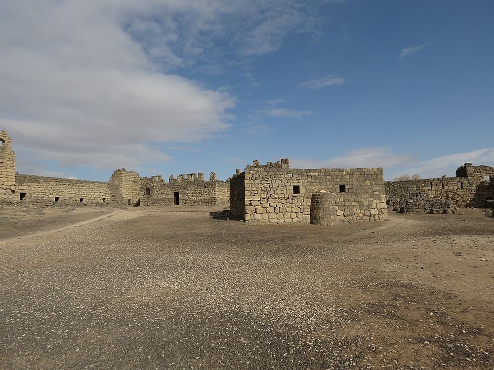
Roman fortress of Qasr Azraq. Photo: xorge/Wikimedia
Architectural remains have also been found in Aqaba, the ancient Aila: a wall and a tower, which are not clear if they belong to the fort or the city, but whose presence is logical as it was a vital port for trade in the region and a crossroads. Whatever the answer, these were structures erected between the end of the 4th and the beginning of the 5th century, being the headquarters of the Legio X Fretensis, which fought in Actium and the Jewish wars before being transferred there from Jerusalem by Diocletian.
There were more important forts, such as those in Bostra, Qasr Azraq, and Humeina, all in Jordan, with the capacity to house five hundred soldiers each. Things changed a bit with the deep administrative reform of the emperor we have mentioned a couple of times, Diocletian. It was he who pushed for defensive reinforcement works against the Sasanian threat and built a new road, the Strata Diocletiana, which started south of the Euphrates, near Sura, and followed the limes until it met the Via Traiana Nova, passing through Palmyra and Damascus, to the northeast of Arabia.
From the Mesopotamian river to the Syrian capital, a series of castella and watchtowers were built; three have been found, although there may have been more (and a legionary camp was added in Wadi al-Hasa).

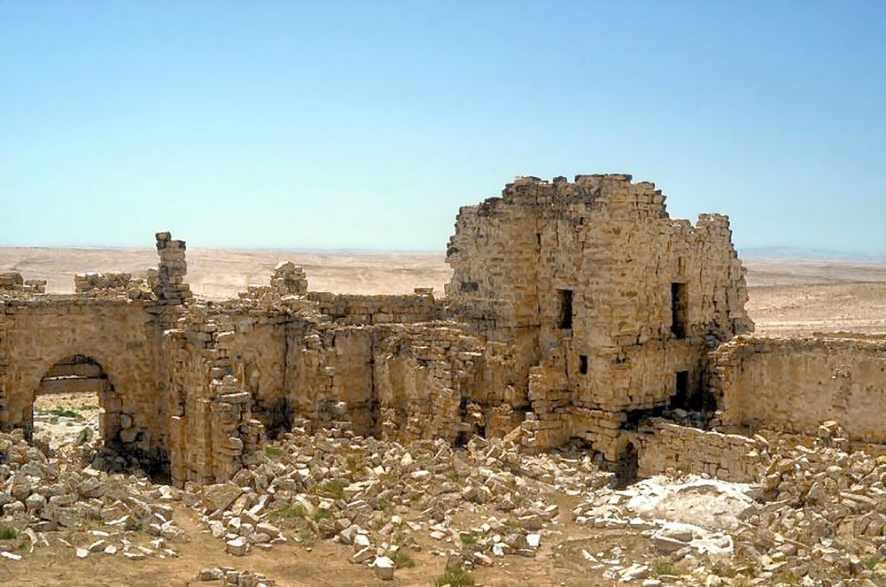
The Fortress of Qasr Bshir. Photo: Mike Bishop/Wikimedia
These bastions, with a rectangular plan, thick walls, and outstanding towers, were located about a day's march apart, adding another ten from Wadi al-Hasa to Aila and constituting a border subdivision that sometimes appears named as Limes Palaestinae, as we said at the beginning. The emperor transferred part of Arabia Petraea to Palestine, including it in the Diocese of the East (which extended to Cilicia, Cyprus, Mesopotamia, and Phoenicia).
A major earthquake in 363 caused significant damage and destroyed the water distribution systems, which along with the decline of caravan routes in favor of maritime trade, resulted in a certain decline. There was no economic or demographic recovery until the territory came under the control of the Eastern Roman Empire, which divided it into three provinces, Palaestina Prima, Palaestina Secunda, and Palaestina Tertia (also known as Palaestina Salutaris), under the military rule of a dux Palaestinae and the civil rule of a praeses (official).
During the first half of the 6th century, Justinian I reinforced the limes. But eventually, the troops were gradually withdrawn and replaced by foederati, mainly Ghassanids (Christian Arabs from Yemen and vassals of Constantinople), who provided protection against the Persians and protected trade against Bedouin raids.
After the Battle of Yarmouk in 636, in which they were defeated -along with Roman allies and Frankish, Georgian, Slavic, and Armenian mercenaries- by the Muslims of the Orthodox Caliphate, the Limes Arabicus was left unguarded and eventually abandoned, although some structures were later repurposed.
This article was originally published in La Brújula Verde. It has been translated from Spanish and republished with permission.


Comments
Post a Comment