In 1884, an Orthodox Christian community that had recently moved to Madaba, a city in western Jordan, began the construction of a new Church of St. George. Under Ottoman law, a Christian church could only be built on the ruins of an older church, and this was done in this case. As workers cleared the ground over what had been the ancient church, there emerged the remains of a mosaic of a very peculiar kind. At that time it was common to find buried mosaic remains linked to the glorious Byzantine and Umayyad past of Madaba. But no previous find could compare with the one that was made in the church of St. George. The colorful mosaic that appeared at their feet depicted sites across the Holy Land, including different geographical features and hundreds of inscriptions in Greek.
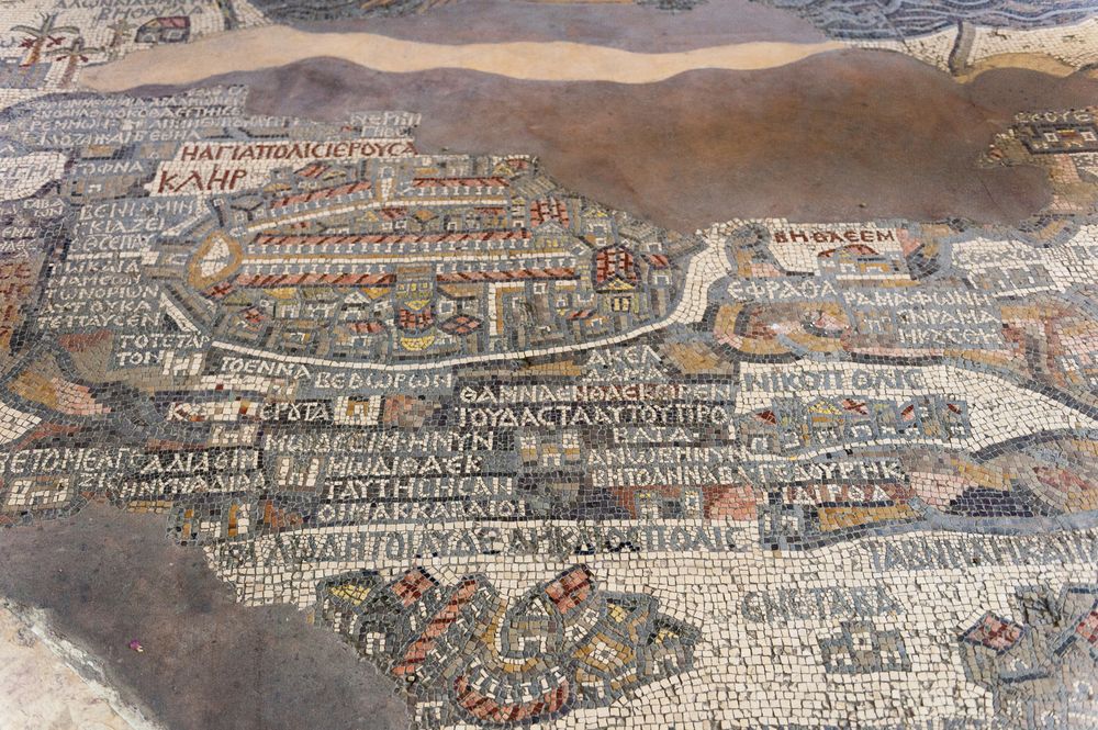
Fragment of the Madaba Mosaic Map, the oldest floor mosaic map of the Holy Land and Jerusalem in the Saint George s Church. Photo: Siempreverde22 | Dreamstime.com
Pnina Arad reports for Haaretz:
The Madaba map is the earliest known map to display the Holy Land and the only known instance in the first millennium of a map depicting a country in full. That is to say that the Madaba map was novel due to the fact that it represented a new kind of visual medium – a graphic description of an entire country, one of the striking features of which was that it didn’t show roads. The map does show mountain ranges, rivers, streams, architectural symbols representing towns and holy sites.
The holy places are depicted via simple structures with red roofs, probably symbolic representations of churches that existed there. The towns are represented through a range of symbols that hint at their varying importance. The Greek titles mostly note place names, but there are also short inscriptions associating particular locations with specific biblical events.
...
What we have here is a picture that combines topography and religious tradition, and that eliminates the gaps between past and present. The inscriptions create a narrative that seemed to have two aims: to place the past of the Scriptures in the geographic space of the land, and to conceptualize that land as a sacred space.
When the inscriptions are categorized by content, one finds that they describe four types of locations: places linked to the divine presence; places where miracles happened; sites where biblical figures operated; and the tombs of biblical figures and martyrs.
All of this hints that the country depicted in the map is a land in which God revealed his presence and power, a land that is holy by virtue of the fact that biblical figures acted there in the past, and is still holy to this day due to the presence of their remains.
The discovery of the map in 1886 excited the locals, but the Greek Orthodox Christian authorities in Jerusalem were slow to react. It wasn’t until a decade later in the mid-1890s that the librarian of the Jerusalem patriarchate, Kleopas Koikylides, visited Madaba to inspect the find. Koikylides immediately realized the importance of the artwork. After carefully cleaning, measuring and drawing the mosaic, Koikylides returned to Jerusalem to officially present it to the Patriarch.
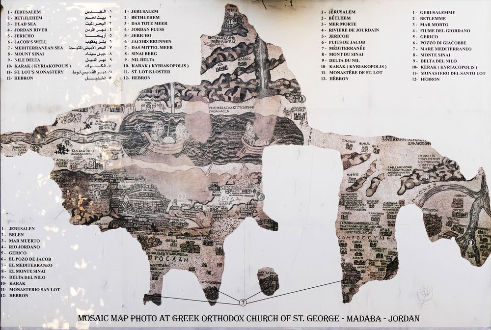
Full view of the mosaic map of Ancient Middle East and The Holy Land at The Greek Orthodox Church of Saint George in Madaba, Jordan. Photo: Ramillah | Dreamstime.com
In January 1897 the Patriarchate asked its most qualified researcher, Professor Georgios Arvanitakis of the Holy Cross School of Theology, to make an exact copy of the mosaic. Arvanitakis drew a copy of the map and a plan of the church with the location of the mosaic. Upon his return to Jerusalem a month later, he marketed his design through reproductions.
The news of the discovery spread quickly among academic circles and different archaeological expeditions were organized from Jerusalem in the race to publish the first complete study of the mosaic. Koikylides, the first to identify the find, and Arvanitakis, the first to investigate it in depth, published their respective reports in March 1897.
The Madaba Map depicts Jerusalem with the New Church of the Theotokos, which was dedicated on 20 November 542. Buildings erected in Jerusalem after 570 are absent from the depiction, thus limiting the date range of its creation to the period between 542 and 570. The original mosaic measured 21 meters by 7 meters and contained more than two million tesserae. Only two large fragments of this mosaic was discovered, occupying an area of approximately 5 meters high by 10 meters long. These two fragments depict an area from Lebanon to the Nile delta, and from the Mediterranean Sea to the Arabian Desert, which includes the territory of the Holy Land. The map is organized around the Jordan River and the Dead Sea as the main axes. It is believed that the representation of Madaba would occupy a relevant place in line with Jerusalem.
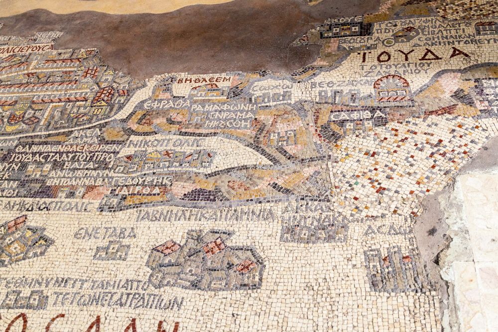
Photo: Matyas Rehak | Dreamstime.com
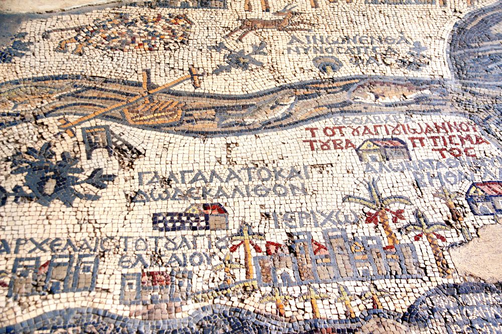
Photo: Frenta | Dreamstime.com
The discovery of the Madaba Map increased archeological interest in this forgotten city, located 33 kilometers from Jordan. Since then, the ruins of a dozen churches and chapels and a considerable number of private residences have been discovered there, as well as hundreds of mosaics. Most of Madaba's mosaics are from the Byzantine period and contain floral and animal motifs as well as scenes of hunting or wine production. The most complete example is the church of the Apostles, which also contains a medallion with the personification of the sea. From the Umayyad period, the mosaic of the church of the Virgin Mary stands out, of geometric type, with dedicatory inscriptions.
The surprising profusion and quality of the mosaics found in the various buildings of Madaba has given this place the moniker “the city of mosaics”. As a result, the city established the Madaba Institute for Mosaic Art and Restoration— the only institute in the Middle East specialized in teaching mosaic conservation and production techniques.

Interior of Greek Orthodox Church of St. George, famous for its extensive mosaic decoration, including the mosaic map of the holy land. Photo: Grandbrothers | Dreamstime.com
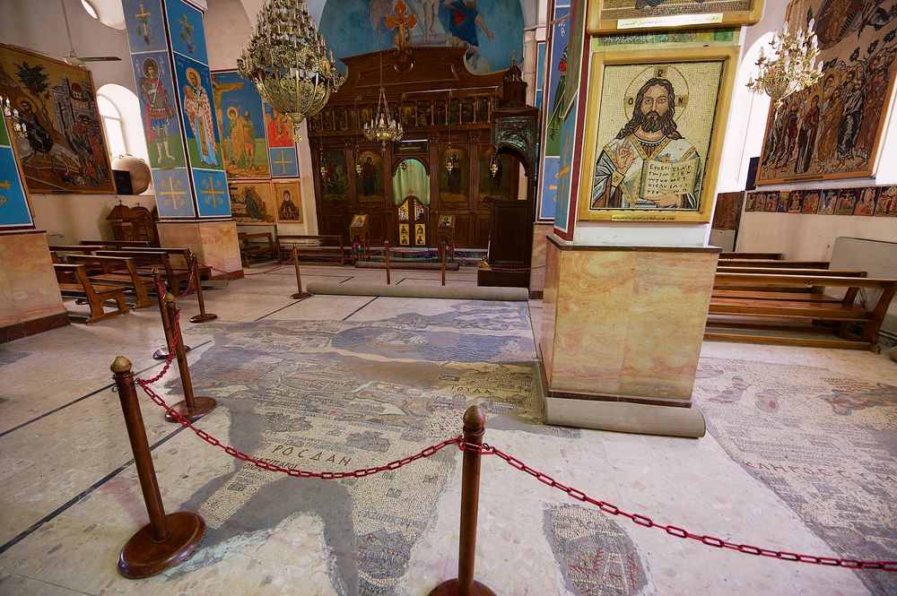
Interior of Greek Orthodox Basilica of St George. with the mosaic map of Holy Land in Madaba, Jordan. Photo: Dmitry Chulov | Dreamstime.com

Tourists visit Byzantine Orthodox Basilica of St George with the mosaic map of Holy Land in Madaba, Jordan. Photo: Dmitry Chulov | Dreamstime.com
References:
# Pnina Arad, Why Roads Aren't Marked on the Madaba Map, the Earliest Map of the Holy Land, Haaretz
# Ruben Montoya, The Mosaic Map Of Madaba, National Geographic
# El mapa mosaico de Madaba, National Geographic
# Wikipedia


Comments
Post a Comment