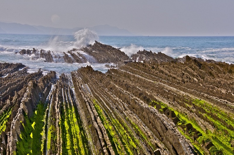
Flysch is a sedimentary rock formed by the alternate deposition of thin layers of silt and sandstone, found near shorelines that were rapidly experiencing changes in sea level. They are formed underwater along the continental shelf when the area undergoes large structural deformation due to interaction of tectonic plates. As the continental plate gets shoved and heaved, landslides deposit layers of sediments. Due to the different sedimentation speed of grains with different size, a gradation takes place. Bigger particles sink faster and build up the ground layer and are overlain by finer grains. These landslides occur in irregular intervals resulting in the formation of layers upon layers of grains with thickness ranging from a few centimeters to several meters in some cases. At some point, structural deformation caused by colliding tectonic plates tilts the sedimentary beds to near vertical. Over time, the less resistant layers weather out more quickly creating long parallel grooves in the rock.

One beautiful example of flysch can be found near the town of Zumaia on the northern coast of Spain. The formation is present at the Itzurun beach, and stretches along a distance of about 8 km, between the towns of Deba and Getaria, with Zumaia lying in the middle. These rocks are also the longest set of continuous rock strata in the world.
The flysch in Zumaia were formed over a period of 100 million years. The collision between the Iberian and European tectonic plates exposed these sediments about 50 million years ago. The layers lean west to east so that older strata are located west while the more recent are on the east. These layers provide valuable information of the earth’s history between 100 and 50 million years ago.
Sources: Tidal zone between Deva and Zumaya (Wikipedia) / Flysch (Wikipedia) / Geocaching


Comments
Post a Comment