Situated on the east coast of Essex, England, on the estuary of River Roach, Foulness Island has long been controlled by the military. The artillery range there was first established by the War Office in the mid-19th century, and is now operated by the Ministry of Defence for testing new weapons and ammunition. Being located a long way from large population centers, the island is ideally suited for this purpose.
The island itself, however, is not free of civilians. Cohabiting with killer grenades, explosive shells and guided missile systems, are a small number of families who grow wheat, barley, peas and linseed on leased land. This bizarre arrangement makes Foulness Island a unique place.

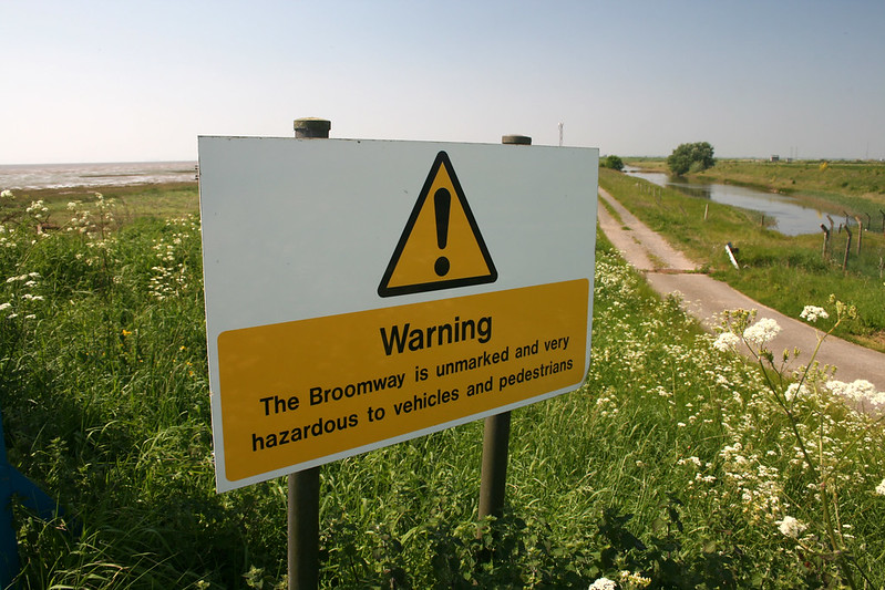
The Broomway. Photo: Adrian Miller/Flickr
For a long time, the only way to reach Foulness Island was by ferry, or by walking along the tidal flats of Maplin Sands when the sea went out. This sea route is called the Broomway, and is allegedly the most perilous path in Britain.
The Broomway begins at a place called Wakering Stairs and then heads east, straight out to sea. After around 400 meters, the route turns northeast and runs in this direction parallel to the coast for around 5 miles, before cutting back towards land at Fisherman’s Head, on the uppermost tip of Foulness island. In good weather, the route feels nothing more than a long walk on a large beach. But when the tide comes in, it comes faster than a man could run. Within minutes, the water is up to your hips and then to your chest. Countless people have lost their lives walking the Broomway.
There is evidence that the Broomway was used as early as 600 years ago, but this ancient route may well predate the Romans, especially since Roman settlements have been found in Foulness Island. It has been suggested that the track was used during Anglo-Saxon times and was subsequently flooded due to coastal erosion. Archeological survey revealed that at least the southern section of the Broomway was once reinforced with wooden hurdle work.

Image: Laris Karklis/The Washington Post
By the end of the 16th century, the Broomway was well marked on maps. On land, the route was marked by a series of short-handled brooms stuck into the mud with the bristle-end sticking up towards the sky. This is where the name comes from. Writing in the early 1900s, author Herbert W. Tompkins described how as the tide ebbed the brooms would “lift their heads and appear as a line of black dots”, providing an indication of when the traveler might start their journey. The brooms required regular maintenance, and since at least the 18th century, the path was funded by the parish and the island's major landowner. By then, the Broomway had become the main route from the island for farmers taking their produce to the market.
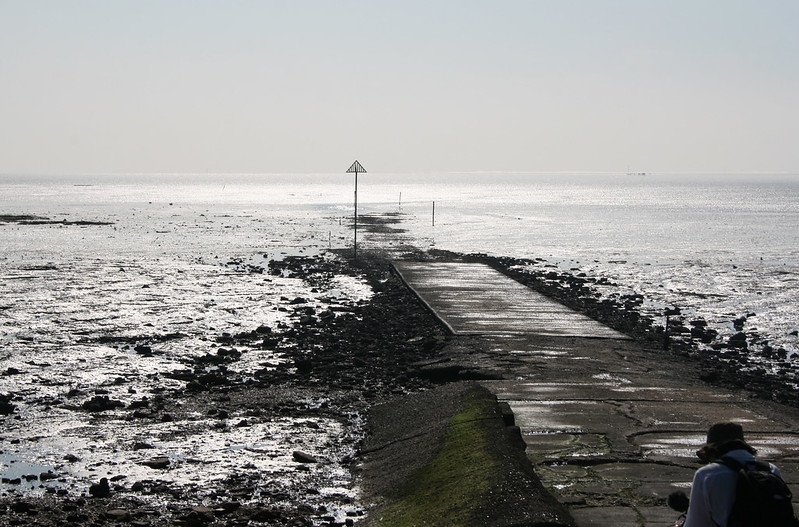
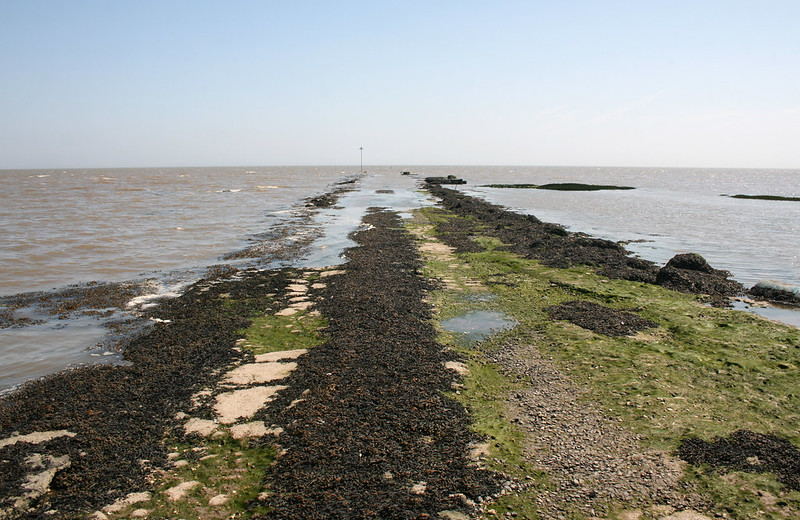
There is more than one hazard on the Broomway, of which the possibility of getting caught in an incoming tide is the worst. The coast is barely visible, and if the fog rolls in or it rains, one can get easily disoriented and wander from the designated path and into soft mud and quicksand. If you could not reach land before the tide comes in, it may mean death.
The other hazard comes from the firing range on Foulness Island. The military routinely shoots artillery into Maplin Sands and the estuary of the Thames, where they explode and form large craters. These craters are filled by the tide with soft mud creating pits of sinking sand which are not obvious to the eye. Then there are risks from unexploded shells.
Nowadays, there is no need to take the Broomway, or the “Doomway”, as locals call it, to reach Foulness Island. The military built a road and a couple of bridges in 1922, connecting the island to Wakering Stairs. Some people still try to reach Foulness island via the Broomway just for the adventure.

References:
# Robert Macfarlane, This desolate English path has killed more than 100 people, BBC
# William Booth, Britain’s ‘deadliest path’, Washington Post
# The Broomway and Foulness Island, Round the Island
# Wikipedia


Nope! There is nothing on that island worth taking such a risk. Thanks for giving me one more thing to add to my Un-Bucket list! Yikes!
ReplyDelete