Nearly every afternoon, from September to March, a thunderstorm develops over the Tiwi Islands in Northern Australia. It happens so regularly that meteorologist refer to it by name—Hector. The cumulonimbus thundercloud appears at roughly 3 PM, and is said to be so reliable that one could set their clocks by him.
Hector, also known as Hector the Convector, earned its name during the Second World War, when pilots and mariners in the region used the thundercloud’s recurring position as a sort of navigational beacon. Hector can reach immense heights, some 20km tall, and is visible all the way from Darwin, a city 100 kilometers away.
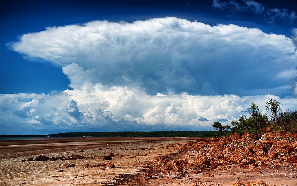
A view of Hector from Gunn Point, Northern Territory. Photo: Djambalawa/Wikimedia
Hector is caused primarily by a collision of several sea breeze boundaries across the Tiwi Islands.
"Southeasterly trade winds extending from the subtropical ridge to the south will normally suppress thunderstorm activity over much of the Northern Territory during the late dry season (September) and at times early in the wet season (October and November), leaving Hector as a prominent but isolated feature on the Darwin skyline," said Ian Shepherd, senior meteorologist at the Australian Bureau of Meteorology.
"The size, shape and location of the Tiwi Islands make them a perfect place for Hector to develop," said Ben Domensino, meteorologist with Weatherzone, a DTN company. "Sea breezes develop over the islands from all sides and meet in the middle. These converging winds, which are carrying moisture from the surrounding sea, have to go somewhere when they clash ... so they go up. This rising column of air becomes cooler with height, which causes water vapour to condense into liquid droplets, forming clouds."
"The tropical atmosphere is almost always primed for thunderstorm formation during the wet season when the converging sea breezes provide the lifting trigger," added Shepherd.
Hector is most common during the warming months of the "build up season" of September-December. Hector can also occur during the "rainy season" from January to March. Sometimes Hector lingers into April if temperatures remain warm enough.
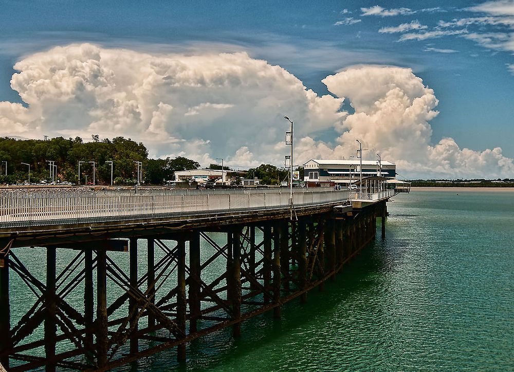
Hector as seen from Stokes Hill Wharf in Darwin. Photo: Djambalawa/Wikimedia
The only days Hector doesn’t form is when there is an active westerly monsoonal flow.
"Cloudy conditions and strong westerly winds associated with an active monsoon tend to suppress sea breezes over the islands, reducing the likelihood of Hector forming regularly," Shepherd said. "An active monsoon also generates regular showers and thunderstorms which move rapidly across the islands from west to east in the relatively cool maritime airstream."
The most suitable conditions for Hector to develop occur when skies are clear with light winds, which allows not only for strong solar heating, but also the formation of daytime sea breezes. In the winter months (May to August in the Southern Hemisphere) Hector does not occur because cooler temperatures decrease the strength of localized sea breezes and limiting the convergence of winds needed to create Hector.
Source: CNN


Comments
Post a Comment