Early in the morning of May 2, 2008, a volcano located about 10 km to the north of the town of Chaitén, near the Gulf of Corcovado in southern Chile, rumbled to life after nearly 10,000 years of inactivity. The plume of volcanic ash rose to 17 km and blanketed the entire town. At that time about 4,000 people were living in Chaiten, who were immediately evacuated. The Chaitén volcano continued to erupt for the next several days becoming increasingly violent. The ash column became 30 km tall and drifted across Chile and Argentina and over the Atlantic Ocean.
The town of Chaiten was not significantly hit by the eruption until heavy rainfall swept the ash and mud deposited in the crater and on the flanks of the volcano into the Chaiten River that flows right past the volcano, continuing its way south and past Chaiten until it drains into the sea. As the lahar gradually filled the river-bed, the water course became shallower until May 12, when the river banks were breached. Since its old bed was full, the water cut a new course right through the center of the town swallowing everything that stood on its way. Nearly half of the town was destroyed.
Chaiten on June 20, 2008. Photo credit: Javier Rubilar/Flickr
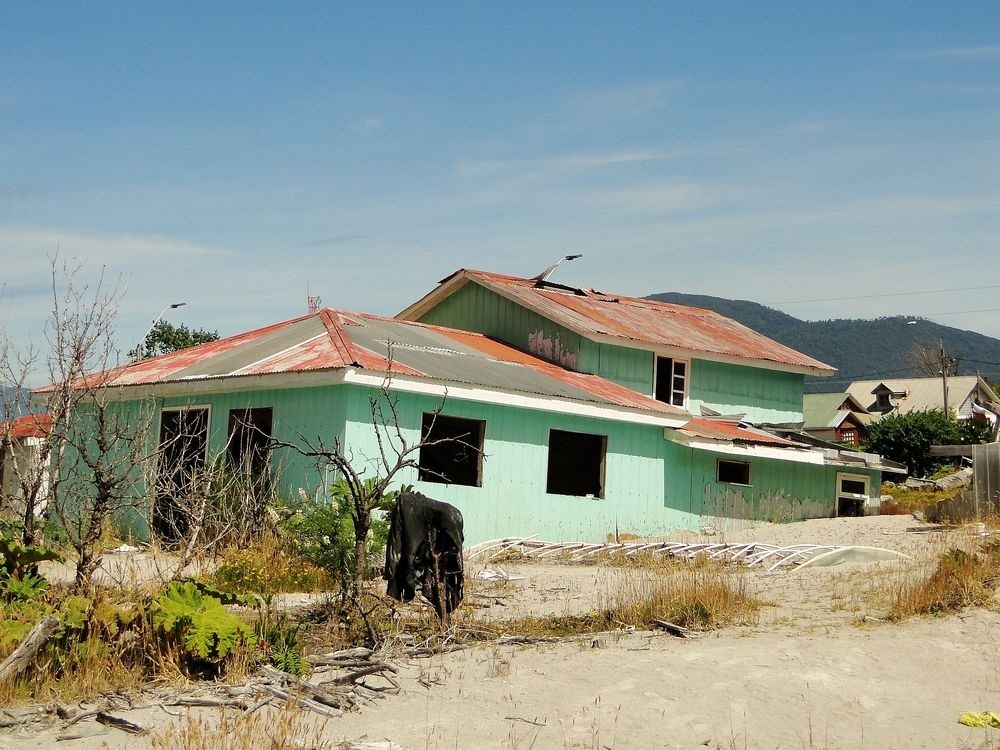
Fortunately, the town was already evacuated so there was no loss of life. But property loss was immense. Buildings collapsed, streets caved in and houses and cars were swept away by the lahar flow.
All these years Chaiten has remained as it was, partially buried under a thick layer of mud. The remaining half of the town that survived the disaster lies next to it, and it thrives from the tourism brought about by the abandoned half.
Originally, after the disaster, the government planned to resettle the residents of Chaiten to a new town, but the residents resisted and decided to stay put. The new Chaiten is now expanding northward away from the coast where the other, mud-caked half remains. But it isn’t any safer than it was. On the contrary, the new town is actually closer to the volcano, and runs the risk of getting buried under another pyroclastic and lahar flow should there be another major eruption. Indeed, on February 19, 2009, just nine months after the first eruption, the volcano erupted again and pyroclastic flows descended down through the Chaitén river valley coming within 5 km from the town of Chaitén.
The volcano’s last eruption occurred in 2011, and it continues to show minor activity.
Related: Montserrat, a Modern Day Pompeii
The eruption of the Chaiten volcano as seen over Chaiten on May 6, 2008, a week before lahar flow engulfed the town. Photo credit: AP Photo/La Tercera
Photo credit: Claudius Prößer/Flickr
Photo credit: Claudius Prößer/Flickr
Photo credit: Sam Beebe/Flickr
Photo credit: Sam Beebe/Flickr
Photo credit: Sam Beebe/Flickr

Photo credit: Robinson Esparza/Flickr
Photo credit: Robinson Esparza/Flickr
Satellite image of the town of Chaiten.
Photo credit: Sam Beebe/Flickr
Sources: Wikipedia / USGS / www.photovolcanica.com / Wikipedia


Let me guess. Caused by global warming.
ReplyDeleteUhh, what?
ReplyDelete