Pont Ambroix, also called the Ambrussum Bridge, was a major Roman bridge across the Vidourle River connecting the end of Villetelle to Gallargues-le-Montueux in modern-day Lunel, France. The bridge was part of the Via Domitia, which was the first Roman road built in Gaul, to link Italy and Hispania through Gallia Narbonensis, across what is now Southern France.
Pont Ambroix was built in the first century BC and originally consisted of 11 arches. The bridge carried the traffic west of Nîmes continuously for 13 centuries until a violent flood dislodged an arch putting the bridge out of use. It was never repaired.
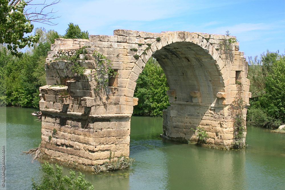
Photo: Dominique LENOIR/Flickr
The Vidourle River is prone to flooding, known locally as Vidourlades, and the bridge with its supporting arches has been carried away piece by piece over the centuries. A sketch of the bridge by Anne Rulman in 1620 shows four arches. An 1839 lithograph and a painting by Gustave Courbet in 1857 show two arches. The floods of 1933 reduced the bridge to its last arch that we see today.
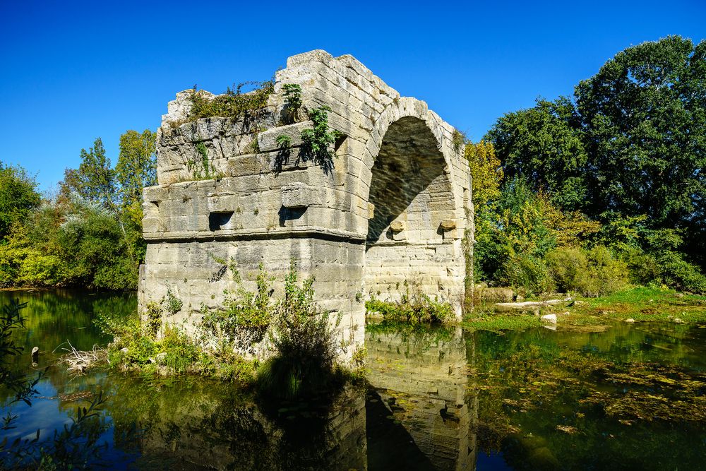
Photo: Steve Shupe/Flickr
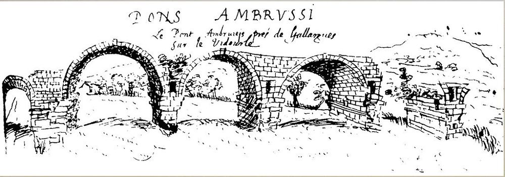
Pont Ambroix on the Vidourle as drawn by Ann Rulman 1620.
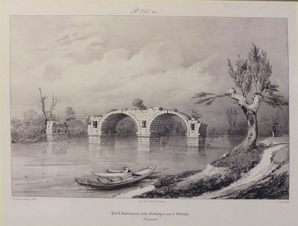
Pont Ambroix on the Vidourle, as printed by Thierry Freres in 1839.
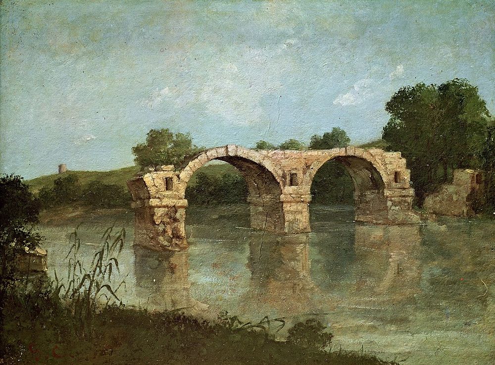
“Le Pont d'Ambrussum” by Gustave Courbet, 1857.


Seems like someone would try to preserve it, even if it meant moving it piece by piece out of the river to somewhere it would be safe before another flood washes the last of it away.
ReplyDelete